


 MKE Album: 6th Street Viaduct
| Name: | 6th Street Viaduct | ||
| Description: | a bridge that links the north and south sides of the Menomonee Valley; it crosses the branches of the Menomonee River twice; descends to the surface of the Valley at Canal Street | ||
| Address: | near | ||
| Coordinates: | 43.033184, -87.918649 (Menomonee River crossing) | ||
| Place Area: | menomoneevalley | ||
| Place Type: | bridge | ||
| Nearby: | (A) 6th Street Viaduct Menomonee River crossing | ||
| 178 meters | NE | to | (B) Milwaukee Intermodal Station |
| 213 meters | S | to | (C) Harley-Davidson Museum |
| 246 meters | NE | to | (D) Stone Creek Coffee Factory Store / Cafe |
| 479 meters | NE | to | (E) We Energies |
| 505 meters | NE | to | (F) Zeidler Union Square |
| 523 meters | SE | to | (G) Reed Street Yards |
| 546 meters | SE | to | (H) Lindsay Brothers Agricultural Implements |

Photo Description: the bridge towers on the south end
Photo Date: 2007-09-08
Place Area: menomoneevalley
Place Type: bridge
Photo Category: scene
Link to Photo

Photo Description: one of the bridge towers on the south end
Photo Date: 2007-09-08
Place Area: menomoneevalley
Place Type: bridge
Photo Category: scene
Link to Photo

Photo Description: looking towards downtown
Photo Date: 2007-09-08
Place Area: menomoneevalley
Place Type: bridge
Photo Category: scene
Link to Photo

Photo Description: plaque on the bridge
Photo Date: 2007-11-03
Place Area: menomoneevalley
Place Type: bridge
Photo Category: scene
Link to Photo

Photo Description: the towers on the north end seen from the sidewalk
Photo Date: 2007-11-03
Place Area: menomoneevalley
Place Type: bridge
Photo Category: scene
Link to Photo
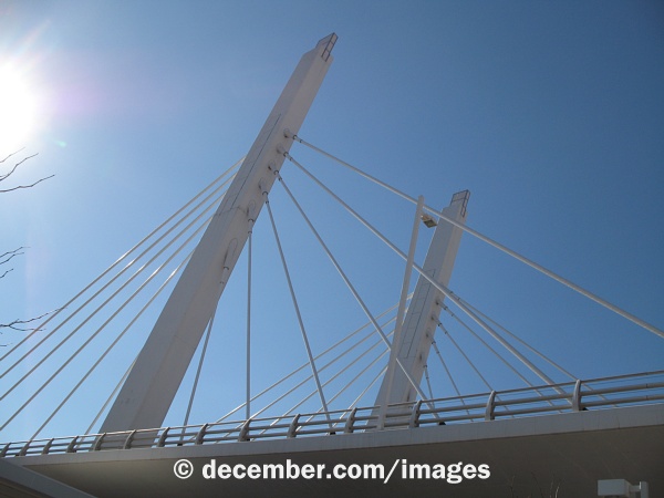
Photo Description: the towers on the north end seen from underneath
Photo Date: 2007-11-03
Place Area: menomoneevalley
Place Type: bridge
Photo Category: scene
Link to Photo
