 Surf Links - Current - Weather - Web sites for browsing Internet content
Current weather reports are available worldwide; you can check major weather portals for current conditions, maps, and forecasts.
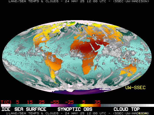
- Satellite Composite image; a global montage created using satellite data, sea surface temperatures and observed land temperatures; provided by the Space Science and Engineering Center, part of the University of Wisconsin-Madison's Graduate School

- Weather.Org: Portal to world weather; easy-to-navigate links to information pages on weather world-wide; information on global Weather, National Weather Service, NOAA US Navy Tropical Storm, surface charts, satellite, radar, storm, hurricane, weather graphics, weather forecasts, wind, seas, tropical storm, snow, weather history, marine aviation, space weather
- Satellite: clickable world map of current satellite data; infra-red channel imagery from many sources, including GOES 10-13, NOAA 15-18, MSG-8, MTSAT-1R, and many more; provided by the Space Science and Engineering Center, University of Wisconsin-Madison
- Global Maps: see weather conditions for Earth; maps include current temperatures, satellite, relative humidity, sunshine, winds, precipitation, and maximum temperatures; specialized maps such as oil spill map, storm tracks, local weather; from Intellicast
- Underground: Weather Underground world weather forecasts and information; weather information and forecasts of all kinds by region and location; network of personal weather stations; interactive weather maps
- World WIS: World Weather Information Service (WWIS); links to official weather information issued by National Meteorological and Hydrological Services (NMHSs); World City Forecasts, Climatology and Weather Observations; World Meteorological Organization (WMO), a specialized agency of the United Nations
- World Cities: table of world cities with current time, sky conditions, and temperature; tables also available for cities by continent
- Ocean Weather: clickable world map showing wave height and direction; regional maps show wind speed in knots (nautical mile per hour) and the wind direction (from which the wind is coming from); provided by Oceanweather, Inc.
- Air Quality: AirNow.gov; gives local real-time air quality; fire and smoke, monitors, recent trends, Forecast AQI, NowCast AQI
- Typical Weather: Weatherspark; Typical Weather Anywhere on Earth; monthly, daily, and hourly graphical reports; compare weather of cities and locations
- Buoys: clickable World Map of buoy data; provided by U.S. Dept. of Commerce, National Oceanic and Atmospheric Administration, National Weather Service, National Data Buoy Center
Is something missing or incorrect? Suggestion?
Please send a note to johndecember@gmail.com with the subject info-surf.
 Surf Links - Current - Weather - Web sites for browsing Internet content


